 Glacier Park Chat
Current weather?

-
Ear Mountain

- Moderator & 2.1 Donator

- Posts: 4981
- Joined: Fri Jun 22, 2007 9:53 pm
- Gender?: Male
- Please add the numbers(11): 11
- Location: Choteau, Montana
- Has thanked: 37 times
- Been thanked: 42 times
- Contact:
Re: Current weather?
Northern areas did get a good rain Saturday night and Sunday. Farther south along the Rocky Mountain Front there was only light rain.scott-atl wrote:My neighbor on the eastside said we got a good soaking.
43 degrees north of Choteau this Monday morning.
Text and photos Copyright 2007-2023.
-
daveparker

- Hiking With Angels

- Posts: 2641
- Joined: Wed Jan 25, 2006 9:00 pm
- Please add the numbers(11): 0
- Location: Kalispell, Montana
Re: Current weather?
We didn't get a drop yesterday, but it was cloudy and cool all day, with a good wind, first time I have put long pants on in a couple of weeks, so it was a nice break from the heat. Now with the weather change, the darn humming birds have gone bonkers, I had to make 3 batches of food for them yesterday, they went through 3 full feeders 3 times over a 12 hour period! They again very active this morning, so I don't know if they know something I don't or we just have another new wave of them that has showed up.
Re: Current weather?
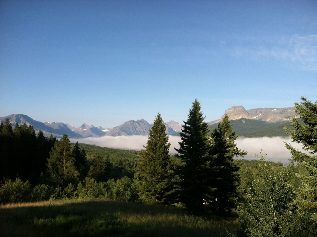
On location eastside. Still relatively green and moist for this time of year. Not raining but the park is socked in w low clouds. Doesn't feel like eminent tinder conditions.
Re: Current weather?
Sorry about the dry conditions over your way. Been there. Hope it gets wet soon. The current weather on the eastside is freaking incredible.
-
PeteE
- Posts: 3346
- Joined: Tue Apr 08, 2014 12:20 pm
- Gender?: Male
- Please add the numbers(11): 11
- Location: Winter hHaven Florida
- Has thanked: 3 times
- Been thanked: 1 time
- Contact:
Re: Current weather?
Looks like I better not forget my Kindle if this forecast holds for the weekend.
Me and Squeeze will be heading out to Logan Pass long before sunrise Friday so I can get a dawn start on my hike to Granite Park Chalet.
Hopefully, I get there before the storms get fired up later in the day.
Then I'll nap and read while those who were fooled by the"deceivingly dry
and calm" conditions in the AM---and consequently didn't pack rain gear---get drenched!
pete
emphasis is mine
...Confidence is growing in a wet and cool trend for the end of the
week, with forecast models showing far more consistency than in
previous days. Friday morning will most likely seem deceivingly dry
and calm, but with increasing instability and plenty of available
moisture, Friday afternoon and evening will prove to be quite
showery, with a good potential for thunderstorm development. By
Saturday, the Northern Rockies (and really, most of the western
United States) will be under the influence of a broad area of low
pressure, which will keep weekend conditions cooler than normal
and showery...
"If you are not curious, you will learn nothing" -Goethe-
"When you're born in this world, you're given a ticket to the freak show.
And when you're born in America, you're given a front row seat."
George Carlin
"When you're born in this world, you're given a ticket to the freak show.
And when you're born in America, you're given a front row seat."
George Carlin
-
PeteE
- Posts: 3346
- Joined: Tue Apr 08, 2014 12:20 pm
- Gender?: Male
- Please add the numbers(11): 11
- Location: Winter hHaven Florida
- Has thanked: 3 times
- Been thanked: 1 time
- Contact:
Re: Current weather?
The weather isn't looking all that promising for my walk to Granite Park tomorrow.
Nothing like walking in a windy, cold rain.
We need the rain, but it needs to rain on someone else's parade, and not mine
The extrapolated forecasts have snow as a possibility along the divide above 8000ft.
It won't amount to much but it illustrates how cool the air will be.
This should be a reminder to new visitors to GNP that you need to bring clothing and gear for a range of temps and conditions.
pete
PS
Jen, I'll be wearing my pants outside my gaiters too
YeeeehawW!!

\00
FXUS65 KMSO 162026
AFDMSO
Area Forecast Discussion
National Weather Service Missoula MT
226 PM MDT THU JUL 16 2015
.DISCUSSION...Isolated thunderstorms across northwest Montana will
continue to bring lightning and brief rainfall through this
evening, mainly affecting Eureka south into the Flathead valley
and points east into Glacier Park. A few showers may stray further
south later this evening, but overall the precipitation will
remain mostly focused north of I-90.
Windy conditions will continue into the evening, though winds
will eventually die down in the valleys tonight. Tonight`s air
mass will be about 3-5 degrees Celcius cooler than last night`s
air mass, resulting in cooler temperatures tonight than last
night. However, some lingering clouds and stronger winds may
prevent some areas from reaching their full cooling potential. As
a result, cold pockets in northwest Montana with temperatures
dropping into the 30s will be sporadic, but many of the valley
locations have the potential to drop into the 30s for an hour or
two tonight, affecting sensitive plants. Frost is not probable,
but is possible, in these areas. The area around Flathead Lake
will not be affected by the cold temperatures due to the
moderating effects of the warm lake water. Central Idaho will see
a cool night with clearing skies overnight, with higher valleys
(such as Dixie) getting down into the 30s.
Tomorrow, showers and thunderstorms will spread across northwest
Montana again, with most of the activity staying north of
Interstate 90. South of Interstate 90, a few showers are possible
during the evening, mainly over the mountains.
Broad low pressure will influence the Northern Rockies through
Saturday and Sunday. That being said, Sunday should be the drier
of the two days, as the low will steadily shift eastward and out
of our area. Temperatures will slowly warm with each passing day
into early next week, remaining around seasonal normals for this
time of year.
The forecast remains fairly benign through roughly Wednesday.
Afternoon showers and isolated thunderstorms could occur, given
continued unstable afternoons and available moisture. That being
said, no major impacts are expected at this time.
Nothing like walking in a windy, cold rain.
We need the rain, but it needs to rain on someone else's parade, and not mine
The extrapolated forecasts have snow as a possibility along the divide above 8000ft.
It won't amount to much but it illustrates how cool the air will be.
This should be a reminder to new visitors to GNP that you need to bring clothing and gear for a range of temps and conditions.
pete
PS
Jen, I'll be wearing my pants outside my gaiters too
YeeeehawW!!
\00
FXUS65 KMSO 162026
AFDMSO
Area Forecast Discussion
National Weather Service Missoula MT
226 PM MDT THU JUL 16 2015
.DISCUSSION...Isolated thunderstorms across northwest Montana will
continue to bring lightning and brief rainfall through this
evening, mainly affecting Eureka south into the Flathead valley
and points east into Glacier Park. A few showers may stray further
south later this evening, but overall the precipitation will
remain mostly focused north of I-90.
Windy conditions will continue into the evening, though winds
will eventually die down in the valleys tonight. Tonight`s air
mass will be about 3-5 degrees Celcius cooler than last night`s
air mass, resulting in cooler temperatures tonight than last
night. However, some lingering clouds and stronger winds may
prevent some areas from reaching their full cooling potential. As
a result, cold pockets in northwest Montana with temperatures
dropping into the 30s will be sporadic, but many of the valley
locations have the potential to drop into the 30s for an hour or
two tonight, affecting sensitive plants. Frost is not probable,
but is possible, in these areas. The area around Flathead Lake
will not be affected by the cold temperatures due to the
moderating effects of the warm lake water. Central Idaho will see
a cool night with clearing skies overnight, with higher valleys
(such as Dixie) getting down into the 30s.
Tomorrow, showers and thunderstorms will spread across northwest
Montana again, with most of the activity staying north of
Interstate 90. South of Interstate 90, a few showers are possible
during the evening, mainly over the mountains.
Broad low pressure will influence the Northern Rockies through
Saturday and Sunday. That being said, Sunday should be the drier
of the two days, as the low will steadily shift eastward and out
of our area. Temperatures will slowly warm with each passing day
into early next week, remaining around seasonal normals for this
time of year.
The forecast remains fairly benign through roughly Wednesday.
Afternoon showers and isolated thunderstorms could occur, given
continued unstable afternoons and available moisture. That being
said, no major impacts are expected at this time.
"If you are not curious, you will learn nothing" -Goethe-
"When you're born in this world, you're given a ticket to the freak show.
And when you're born in America, you're given a front row seat."
George Carlin
"When you're born in this world, you're given a ticket to the freak show.
And when you're born in America, you're given a front row seat."
George Carlin
-
Jen
Re: Current weather?
I don't use gaiters for thunderstorms. I pack rain pants .macchia wrote: PS
Jen, I'll be wearing my pants outside my gaiters too
YeeeehawW!!
Safe travels out and back!
-
PeteE
- Posts: 3346
- Joined: Tue Apr 08, 2014 12:20 pm
- Gender?: Male
- Please add the numbers(11): 11
- Location: Winter hHaven Florida
- Has thanked: 3 times
- Been thanked: 1 time
- Contact:
Re: Current weather?
Got rain pants too.
43F this morning here in WF and clear.
Hope it's like that on the highline!
See y'all Sunday night.
Outa here at 0430
Yeeeehaww
pete
43F this morning here in WF and clear.
Hope it's like that on the highline!
See y'all Sunday night.
Outa here at 0430
Yeeeehaww
pete
"If you are not curious, you will learn nothing" -Goethe-
"When you're born in this world, you're given a ticket to the freak show.
And when you're born in America, you're given a front row seat."
George Carlin
"When you're born in this world, you're given a ticket to the freak show.
And when you're born in America, you're given a front row seat."
George Carlin
Re: Current weather?
Socked in w rain and 48 on the eastside this eve. You can feel the park soaking up every bit.

-
Jen
Re: Current weather?
I heard they were getting snow at Logan pass?paul wrote:Let's hope Pete is staying dry at the chalet.
