 Glacier Park Chat

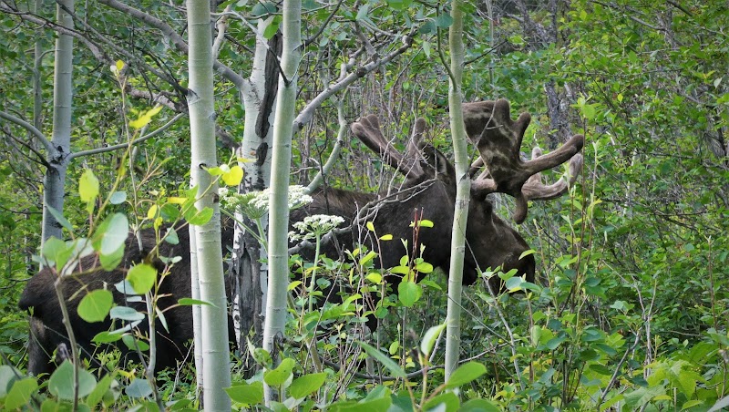
Tina thot we could walk along the beach and catch a bit of a non-use trail to take us over to the main Stoney Indian Pass Trail but alas, the water was too high so we had to back track to the food court and take the campsite trail. Maybe it was a bit fortuitous as we got to see another large moose eating off to our right so we enjoyed watching that for a moment.
As we walked in and out of the forest and in and out of the meadows, the wildflowers were still showing off
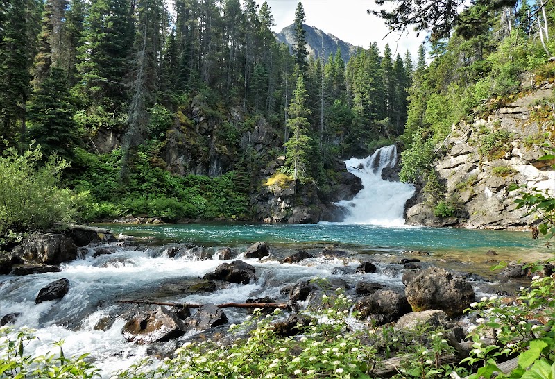
Tina practiced her flower learning and learned some more as we headed up and down not too far from the lake. We would constantly steal a glance to the west as we continued toward our first stop and past the Cosley crossing where we were now on the Cosley Cutoff Trail. We stopped to check out the trail to the Bear Mountain Lookout and encountered some hikers that were on their way out. Their older father was with them and apparently was a little gimpy so they were hiking ahead. Soon we arrived at the side trail to Gros Ventre Falls. It may not be tall but it's mighty and only a short trek down to the Mokowanis River to behold this site. It's less than a mile and 1/2 from camp. I grew up between two Indian tribal lands in northcentral Montana, the Gros Ventre was one of them. We only stayed at the Falls for about ten minutes. I took way too many pictures and video. But it was so nice here.
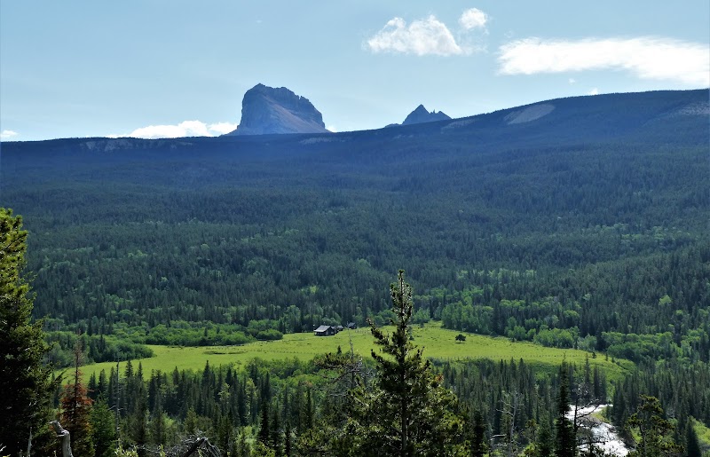
Onward we continued. Sadly you don't get to see the Mokowanis River for the rest of the trip. A little ways into the forest we encountered the Glacier Guides group. We would yo-yo with them a couple times. Eventually you come out of the forest and have your first views of Chief Mountain and Ninaki with its spires as they hover above the meadow which hosts the Ranger Station below us. You don't realize how high above the valley you are as it doesn't seem like you climbed up at all; in fact you've been coming down out of the Mokowanis Drainage which is higher than it seems.
So you do a little criss-crossing on this flank of Bear Mountain and head down toward the river. I find myself looking south at the mountains of the Belly River Drainage where we were 5 days ago. I still take glances back to the mountains of the Mokowanis as well. Once at the bridge, it's a one at a time thing so we let the Glacier Guided group go across. Apparently they were making a game of getting across this sway bridge: don't grab the cables. The last two did a pretty good job and didn't grab the cables but then the sweeper came up and she nearly ran across
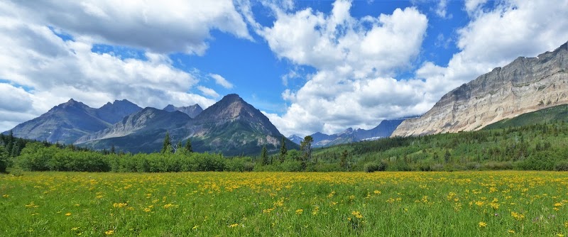
Next up is our lunch stop at Gable Campground. We talked to another couple while there. They had their fishing poles. But now, it was time to knock out these last six miles. The meadows were still alive with wildflowers everywhere and the clouds were also putting on a bit of a show.
The trail was still problematic in places from the rains. We would encounter a couple different hikers but when Tina recognized a ranger in civilian gear, he was with his wife, we both stopped to chat and realized we had both gone on a ranger-guided Iceberg Lake hike with Ranger Schultz of Oregon. How about that! Glacier's like that. Remember in 2017 when Wendy and I were running into all sorts of people not once but a few times.
We stopped at where we think the old Three Mile Trail was to have a snack and rest up for our last three mile push of which the last 2 was 720 feet elevation gain. It did start to get warm and humid as we tried to keep our pace up and I kept waiting for the forest which I thot was much closer. The forest finally came in the last mile and the trail was very nice too. We still enjoyed the trek through the forest with its mostly Thimbleberry ground cover. And before you knew it, we were at our vehicles with no parking signs behind them as they were re-paving the lot and had to work around vehicles coming and going. I am sure they were frustrated with ours being there for six days.
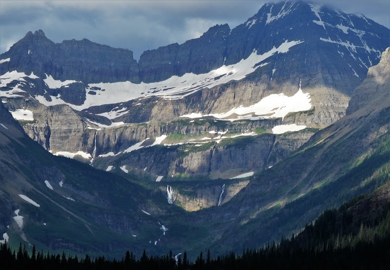
Cosley Lake to and at Gros Ventre Falls
Gros Ventre Falls to Chief Customs TH
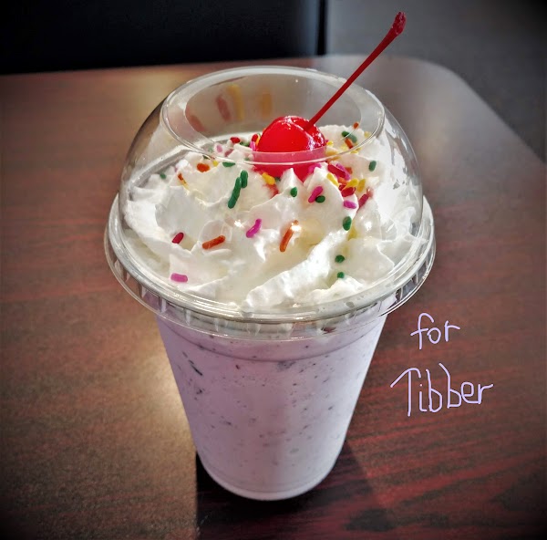
We parted company, Tina for Calgary and me for Chester. I stopped at Two Sisters to have a salad and huckleberry beer. But alas, it was some sort of Indian Days so being on the reservation, it was dry; I had to settle for a Huckleberry Milkshake to go.
The drive to Chester wasn't too bad except I had to stop and fuel up in Shelby and pick up some munchies and check with Cousin Connie to see if I could bring anything for dinner. US 2 (the one that goes across the entire USA) was under complete reconstruction around Galata so I had to drive 35 MPH for about 9 miles. What's surprising about that is everyone else was driving that speed too which is highly unusual for Montana drivers
The next two days I got to enjoy the ranch and lots of cousins. My cousin Connie kept me well fed which was pretty darn nice after 6 days of hiking/backpacking. Here is a link to a video as we drove around some of the Romain ranches and of course, I posted our kayak trip on the Marias and the ranches here: https://hikearizona.com/photoset.php?ID=55004 Here is a link to the video I created of the drive around the ranches and includes pics from the kayaking trip on the Marias where we were lucky to just beat the worst of a hail storm:

